How a record-strength El Niño could amplify climate disruption
El Niño conditions appeared in the central and eastern equatorial Pacific in May, after which sea-surface temperature indices rose rapidly.
El Niño conditions appeared in the central and eastern equatorial Pacific in May, after which sea-surface temperature indices rose rapidly, according to China’s National Climate Centre.[4] Officials project the index will peak around November at 3.2°C to 3.5°C, which would make the event the strong…
El Niño conditions appeared in the central and eastern equatorial Pacific in May, after which sea-surface temperature indices rose rapidly, according to China’s National Climate Centre.[4] Officials project the index will peak around November at 3.2°C to 3.5°C, which would make the event the strongest since instrumental measurements began.[4]
Why it matters: The projected peak provides a measurable near-term indicator of an extreme Pacific warming event that can compound heat in an already warming climate system.[4][5]
Key insights: The event’s development is being tracked through sea-surface temperature indices in the central and eastern equatorial Pacific.[4] | China’s projected November peak is between 3.2°C and 3.5°C.[4] | The 2026 UN Climate Summit emphasized adaptation, resilience monitoring and renewable-energy deployment as key responses to intensifying climate impacts.[5]
Cheatsheet facts: What changed: Chinese meteorologists upgraded expectations to the strongest super El Niño since instrumental records began.[4] | Why now: Pacific El Niño conditions emerged in May and the relevant sea-surface temperature indices have since risen rapidly.[4] | Watch next: Watch whether the index reaches the projected 3.2°C to 3.5°C peak around November.[4]
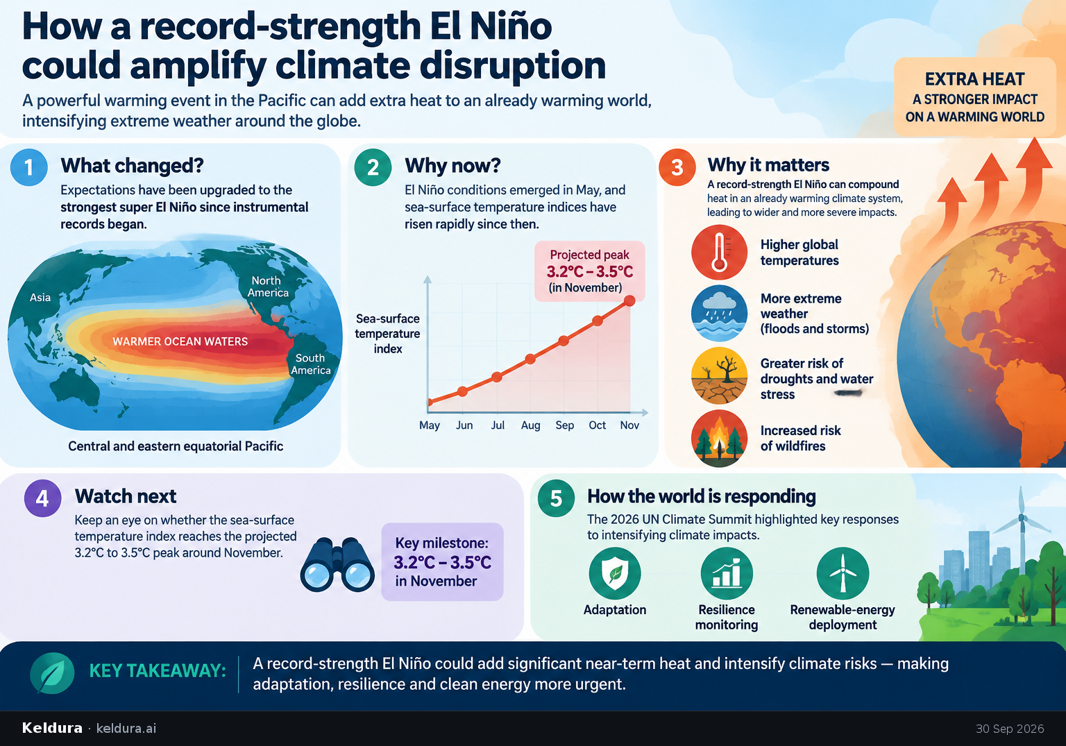
El Niño conditions appeared in the central and eastern equatorial Pacific in May, after which sea-surface temperature indices rose rapidly, according to China’s National Climate Centre.[4] Officials project the index will peak around November at 3.2°C to 3.5°C, which would make the event the strongest since instrumental measurements began.[4]
Why it matters: The projected peak provides a measurable near-term indicator of an extreme Pacific warming event that can compound heat in an already warming climate system.[4][5]
Key insights: The event’s development is being tracked through sea-surface temperature indices in the central and eastern equatorial Pacific.[4] | China’s projected November peak is between 3.2°C and 3.5°C.[4] | The 2026 UN Climate Summit emphasized adaptation, resilience monitoring and renewable-energy deployment as key responses to intensifying climate impacts.[5]
Cheatsheet facts: What changed: Chinese meteorologists upgraded expectations to the strongest super El Niño since instrumental records began.[4] | Why now: Pacific El Niño conditions emerged in May and the relevant sea-surface temperature indices have since risen rapidly.[4] | Watch next: Watch whether the index reaches the projected 3.2°C to 3.5°C peak around November.[4]
X copy pack
Edition complete
You've reached the end of this edition.